London's Lost Canals - The Cumberland Arm of The Regents Canal
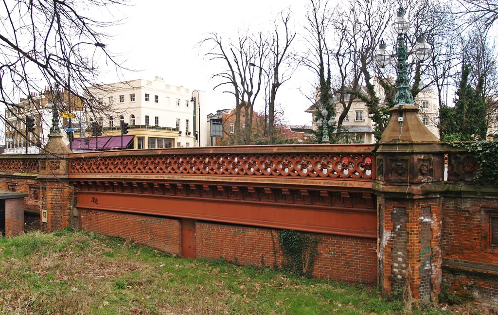
The Cumberland Arm of the Regents Canal canal once ran under the Gloucester Gate Bridge
|

crumbling motifs on Gloucester
|
Gate Bridge in Camden
|
|
The Cumberland Market Branch of the Regent’s Canal known as The Cumberland Arm was a half mile branch of the Regents Canal from a junction at Regents Park running parallel with Albany Street behind Regents Park Barracks and finishing in its basin at a former market near Euston Station. The Arm was built the same time as the rest of the Regents Canal in 1816.
The Regents Canal linked the Grand Junction Canal's Paddington Arm with the River Thames at Limehouse and provided a link for barge traffic for ammunition between Woolwich Arsenal and the Barracks. Cumberland Basin was lined by a collection of wharfs and warehouses. Hay and straw were brought in for sale at the Market and for the horses at the nearby barracks. Cumberland Market was built in the 1820s as a relocation of the hay market in Piccadilly. Throughout its existence the hay market operated for three days a week alongside a general produce market. Ice was brought in for an icehouse that was eighty-two feet deep and with a capacity of 1,500 tons under the Market. Large barges would also arrive with heavy goods such as stone and lime and a number of monumental masonry businesses opened in the Euston Road to take advantage of this. However by the 1850s the canal trade had declined and Cumberland Basin became polluted and cholera spread through the families of men who were employed on the barges and in the wharves around it and took hold in the overcrowded neighbourhood. However, a market continued on the site right until the late 1920s, and the last few trading barges ceased sometime in the early 1930s. The surrounding buildings were demolished and replaced by council housing. During the war, the arm was used to supply water to fire pumps attending fires through the West End.
Before the end of the war the Basin was filled in with rubble from wartime damaged buildings and in the years following the Second World War the site was covered with topsoil brought in from Windsor Castle and turned into allotments.
All that remains today of the Arm is a tiny stub at the old junction with the main part of the Regents Canal used for mooring barges and a large floating Chinese Restaurant. Beyond this is now the car park for London Zoo Past the car park is the Gloucester Gate Bridge with its impressive lamp holders and crumbling motifs. The bridge carried the Prince Albert Road across the Arm. The view to the south of the bridge is of the infilled canal converted to gardens at the back of houses designed by John Nash. These ornate houses were originally built on both sides of the canal which at the time provided a central focus to the exclusive housing estate. Regents Park Barracks still exist & is the base of 20 Transport Squadron, Royal Logistic Corps, the Artists Rifles and The Regimental Headquarters of the Queen's Royal Hussars. The allotments around the Cumberland Basin are surrounded by blocks of flats and there is no evidence of the old market at all. Derelict barges are believed to be buried underneath and remnants have been discovered by allotment holders.
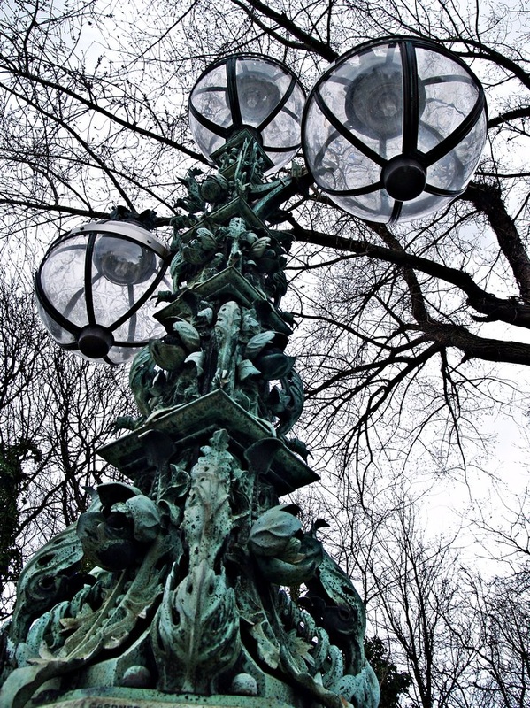
Bronze lampstandards in the form of candelabra on Gloucester Gate Bridge
|
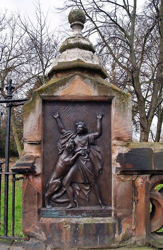
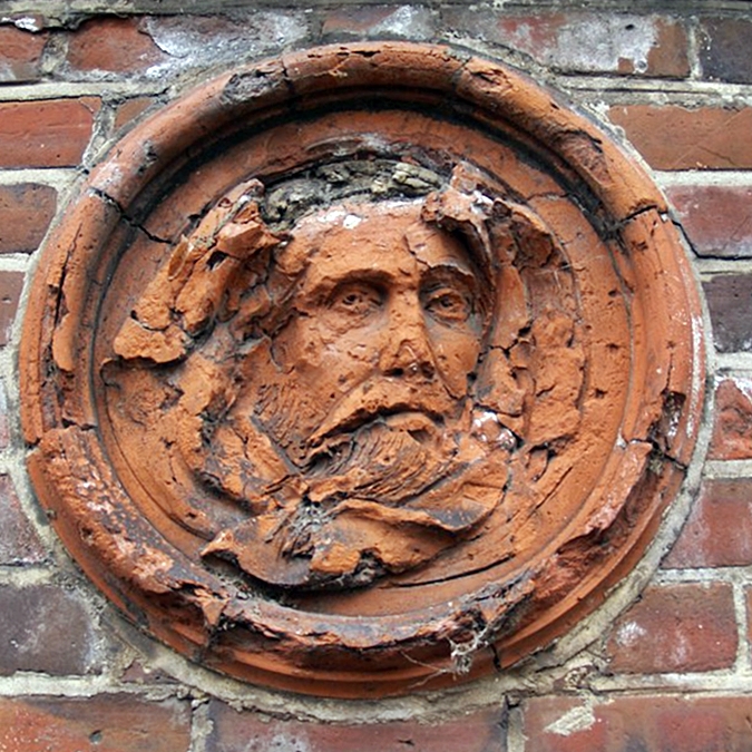
Bronze relief plaque depicting the
martyrdom of St Pancras by CE Fucigna on Gloucester Gate Bridge
|
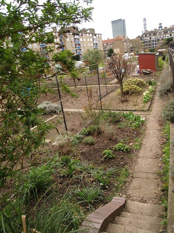
Allotments now cover the site of the canal basin between Regent's Park and Euston railway station
|